https://www.darabanth.com/
https://static.darabanth.com/
https://static.darabanth.com/auction/img/
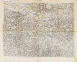
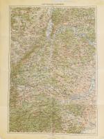
Zahl der Lose: 236
| bis 1 000 HUF | 100 HUF |
| bis 5 000 HUF | 200 HUF |
| bis 10 000 HUF | 500 HUF |
| bis 20 000 HUF | 1 000 HUF |
| bis 50 000 HUF | 2 000 HUF |
| bis 100 000 HUF | 5 000 HUF |
| bis 200 000 HUF | 10 000 HUF |
| bis 500 000 HUF | 20 000 HUF |
| bis 1 000 000 HUF | 50 000 HUF |
| bis 2 000 000 HUF | 100 000 HUF |
| bis 5 000 000 HUF | 200 000 HUF |
| bis 10 000 000 HUF | 500 000 HUF |
| ab 10 000 000 HUF | 1 000 000 HUF |
Filtern bei der Auktion
Gesamtsumme:


![[Szicília színezett rézmetszetű térképe] Homann Heirs: 1747 Regni & Insulae Siciliae Tabula geographica, ex Archetypo graniori in hoc compendium redata . . . Ao. 1747 . / copper plate map of Sicily 463x540 mm](https://static.darabanth.com/images_thumbs/3/3/3345018.jpg)
![[Perzsia színezett rézmetszetű térképe] Opulentissimi Regni Persiae... Seutter, George Matthaeus (1678 - 1757), cca 1740. / Colored copper plate map of Persia 495x580 mm](https://static.darabanth.com/images_thumbs/3/3/3345000.jpg)
![[Nagy Sándor birodalmának rézmetszetű térképe] 1731 Guillaume De L'Isle (1675-1726): Alexandri Magni Imperium et Expeditio... szélén beszakadásokkal. 470 x 840 mm / copper plate map of Sicily 470 x 840 mm](https://static.darabanth.com/images_thumbs/3/3/3345050.jpg)

![[A Nyugat-Római birodalom rézmetszetű térképe] 1763 Jean Baptiste Bourguignon d'Anville (1697-1782): Orbis Romani, pars occidentalis. Auspiciis Serenissimi Principis Ludovici Philippi, Aurelianorum Ducis publici juris facta. Auctor d'Anville, Regiae Humaniorium Litterarum Academiae, et Scientiarum Petropolitanae Socius, Celsitudinique Serenissimae a Secretis. MDCCLXIII. Szélén restaurált / copper plate map of the Western Roman Empire with restoration 550x680 mm](https://static.darabanth.com/images_thumbs/3/3/3345008.jpg)