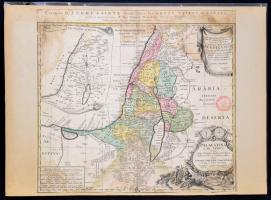
1750 Izrael 12 törzse. rézmetszetű térkép. kartonra kasírozva, kis sérülésekkel. Palaestina in XII. Tribus divisa. cum Terris Adiacentibus debuo revise & copiolor reddita Studio. Iohannies Christoph. Harenbergii- Kartonon, kis sérülésekkel./ 1750 Homann Heirs Map of Israel - Palestine - Holy Land (12 Tribes). Glued on cartbord, with some damages. 53x49 cm
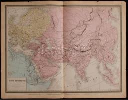
Berghaus, Heinrich, Dr.: Vollständiger Universal-Handatlas der neueren Erdbeschreibung über alle Theile der Erde in 82 Blättern, herausgegeben von Dr. K. Sohr und F. Handtke. Fünfte Auflage, vermehrt und verbessert durch --. Glogau, 1855. Carl Flemming. [2] p. + 88 színezett térképlap. (Hiány: 4 db: 10, 20,21, 65) Folio. 45x38 cm Borító nélkül, a címlap kissé rojtos, de a térképlapok jó állapotban. / 88 etched maps. Without cover 4 pages missing (10,20,21,65)
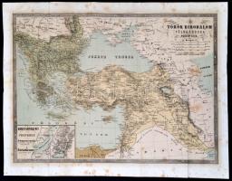
1854 A török birodalom földabrosza, színes kőnyomat, Fényes Elek: A török birodalom, leirása, történeti, statistikai és geographiai tekintetben (Pest, 1854. Heckenast Gusztáv) c. könyvből, foltos, a hajtások mentén kis szakadásokkal, szakadt, a hátoldalon javítással, 42x53 cm.
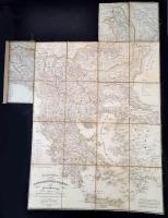
Kyssl Franz. Generalcharte von der europaischen Türkey u. Griechenland. Gratz, 1828. Határszínezett litografált térkép. Teljes. Vászonra kasírozva, jó állapotban. / Lithographic map of Turkey, Greece, Romanian countries and the Balkans. Colored, on canvas. 100x74 cm
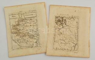
cca 1690 A lengyel királyságot ábrázoló rézmetszetű térképlapok. Megjelent: Alain Manesson Maller: Description de l'Univers.. Paris,1683./ Maps of Poland, the Polish Kingdom Etching. 11x17 cm
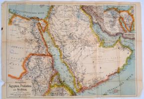
Vegyes térkép tétel: Tanzánia térképe, nagyméretű, vászon Dolomitok térkép, Tote Gerbirge panorámakép, Egyiptom első világháborús térkép, Börzsöny turistatérkép, összesen 4 térkép és egy panorámakép nagyrészt jó állapotban
cca 1930 Laibach, Linz és St Pölten és környéke. 5 db jó állapotú, magyar kiadású térkép / cca 1930 Austria 5 maps in good condition: Linz, Laibach and St Pölten and area map 47x65 cm

![Berghaus, Heinrich, Dr.: Vollständiger Universal-Handatlas der neueren Erdbeschreibung über alle Theile der Erde in 82 Blättern, herausgegeben von Dr. K. Sohr und F. Handtke. Fünfte Auflage, vermehrt und verbessert durch --. Glogau, 1855. Carl Flemming. [2] p. + 88 színezett térképlap. (Hiány: 4 db: 10, 20,21, 65) Folio. 45x38 cm Borító nélkül, a címlap kissé rojtos, de a térképlapok jó állapotban. / 88 etched maps. Without cover 4 pages missing (10,20,21,65)](https://static.darabanth.com/images_thumbs/1/7/1701992.jpg)