https://www99.darabanth.com:443
https://www.darabanth.com/
https://static.darabanth.com/
https://static.darabanth.com/auction/img/
Tételek lista
Number of items: 105
Auction is over! Item soon called at the auction hall
Catalog number ascending
Catalog number descending
Starting price ascending
Starting price descending
12
24
48
72
2804145
13556
434
0
2000
Maps
Artworks & Paper
1
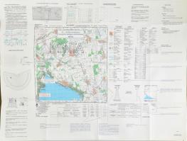
2003 Balatonalmádi, topográfiai oktatótérképe, 1: 50 000, 70×94 cm
Starting price:
2 000 HUF
2804136
13557
434
0
3000
Maps
Artworks & Paper
1
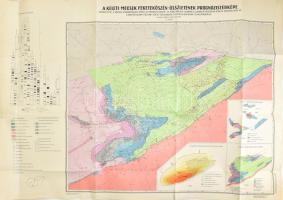
1968 A Keleti-Mecsek feketekőszén-összetételének prognózistérképe, 1:50 000, 68×99,5 cm
The item is not available
Starting price:
3 000 HUF
2804129
13558
434
0
3000
Maps
Artworks & Paper
1
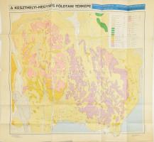
1979 A Keszthelyi-hegység földtani térképe, 82×88 cm
Starting price:
3 000 HUF
2804126
13559
434
0
3000
Maps
Artworks & Paper
1
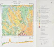
1990 Győr-Dél földtani térképe, kétnyelvű, 1:100 000, Magyar Állami Földtani Intézet, 55×65 cm
Starting price:
3 000 HUF
2807163
13560
434
0
3000
Maps
Artworks & Paper
1
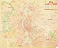
1941 Budapest térkép, Az Utca Rendje melléklete, szakadt, foltos, javított, az egyik sarkán hiánnyal, 90x75 cm,
The item is not available
Starting price:
3 000 HUF
2807148
13561
434
0
3000
Maps
Artworks & Paper
1
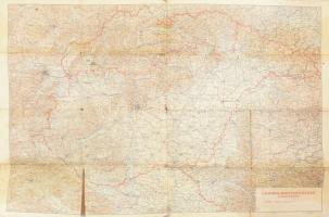
1939 Csonka-Magyarország közigazgatási térképe a visszatért területekkel (Felvidék, Kárpátalja), M. Kir. Honvéd Térképészeti Intézet, 1:750000, szakadt, 69×100 cm
Starting price:
3 000 HUF
2696451
13562
434
0
5000
Maps
Artworks & Paper
1
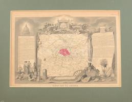
cca 1850 Départment du Seine (Franciaország) megye térképe, Atlas National Illustre, 42x28 cm. paszpartuban/ cca 1850 Map of Départment du Garonne (France), Atlas National Illustre, 42x28 cm
The item is not available
Starting price:
5 000 HUF
2696854
13563
434
0
4000
Maps
Artworks & Paper
1
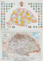
Magyarország a Trianoni Békeszerződés előtt és után 2 db térkép az egyik a vármegyék címereivel. Modern nyomatok. 60x43 cm
The item is not available
Starting price:
4 000 HUF
2696450
13564
434
0
5000
Maps
Artworks & Paper
1
cca 1850 Départment du Loire (Franciaország) megye térképe, Atlas National Illustre, 42x28 cm. paszpartuban/ cca 1850 Map of Départment du Garonne (France), Atlas National Illustre, 42x28 cm
The item is not available
Starting price:
5 000 HUF
2696693
13565
434
0
24000
Maps
Artworks & Paper
1
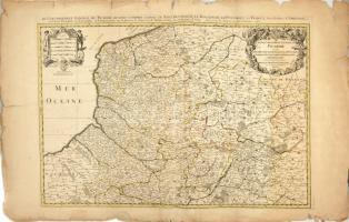
Le Gouvernement General De Picardie, ou sont le Pays Reconquis, Le Bulenois, Le Ponthieu, l'Amienois, Le Santerre, Le Vermandois et Le Tierrache. Alexis-Hubert Jaillot. 1692. Színezett rézmetszetű térkép Franciaroszág Picardia tartományáról. A lap szélén szakadásokkal. / Hand colored engraving. 800x560 mm
The item is not available
Starting price:
24 000 HUF
2696710
13566
434
0
3000
Maps
Artworks & Paper
1
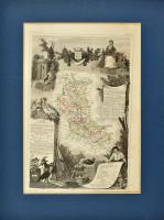
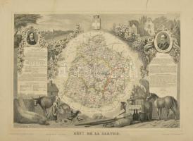
cca 1850 Départment du Sarthe (Franciaország) megye térképe, Atlas National Illustre, nagy beszakadással, 42x28 cm. / cca 1850 Map of Départment du Sarthe (France), Atlas National Illustre, with tear 42x28 cm
The item is not available
Starting price:
3 000 HUF
2810784
13567
434
0
1400
Maps
Artworks & Paper
1
1938 Stadtplan von Gross-Leipzig / Lipcse várostérkép, 1 : 15.000, Verlag von Moritz Ruhl, Lepzig, 37,5x26 cm
The item is not available
Starting price:
1 400 HUF
The bids are accepted according to the following bid increments:
up to 1.000 HUF
100 HUF
up to 5.000 HUF
200 HUF
up to 10.000 HUF
500 HUF
up to 20.000 HUF
1.000 HUF
up to 50.000 HUF
2.000 HUF
up to 100.000 HUF
5.000 HUF
up to 200.000 HUF
10.000 HUF
up to 500.000 HUF
20.000 HUF
up to 1.000.000 HUF
50.000 HUF
up to 2.000.000 HUF
100.000 HUF
up to 5.000.000 HUF
200.000 HUF
up to 10.000.000 HUF
500.000 HUF
over 10.000.000 HUF
1.000.000 HUF
further page navigation Auction house
Address:
Mailing Address:
Phone:
E-mail
:
icvqw34r5 nf?3+ o@dasdfefg rabanwf34 th.codv4 m
Opening hours:
Monday: 12-17
Tuesday-Wednesday: 10-17
Thursday: 10-19
Friday: closed
Weekend: closed
© 2011-2025 Darabanth Auction House Co., Ltd.
We use cookies on the Darabanth website to enhance your user experience.
I agree
For details, please click here
https://www.darabanth.com/en/terms-and-conditions-faq
darabanth.com
H
Item added to the basket
Continue shopping