cca 1970-1980 Az Egyesült Államok térképe. Rand McNally Panoramic Map of the United States, a hajtások mentén szakadásokkal, a sarkoknál kis sérülésekkel, 87x132 cm./ Rand McNally Panoramic Map of the United States, with damages, 87x132
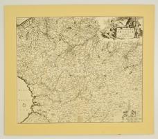
cca 1680 Artois és környékének térképe, Tabula Comitatus Artesiae emendata a Frederico de Wit. Nagyméretű rézmetszet, díszes kartussal, paszpartuzva / Map of county of Artois and area in France. Large etching by Frederic de Wit. In paspartu 56x46 cm
1797 Az Osztrák Birodalom politikai és egyházigazgatási térképe. Maiestas Austriaca sive circul. Archi Ducat. Austriae cum ceteris Augustissimae huic Domus per Germaniam continuo ferme tractu devotis Haereditariis Terris... Seutterus, Matthaeus - Joh. M. Probst. Színezet rézmetszet, kis hiánnyal. / Political and clerical map of the Austrian Empire. Colored etching, Small part missing. Wide margins. 57x50 cm
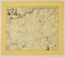
cca 1680 A holland Limbrucht és Valckenbrucht grófság térképe, Tabula Ducatus Limbrucht et Comitatus Valckenbrucht in lucem edita a F de Wit. Nagyméretű rézmetszet, díszes kartussal, paszpartuzva / Map of county and dukedom of Limbrucht and Valckenbrucht in Holland. Large etching by Frederic de Wit. In paspartu 56x46 cm
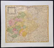
1757 Friedrich Zollmann; Adam Friedrich Zurner: Szászország rézmetszetű térképe. Circuli Super. Saxoniae Pars Meridionalis sive Ducatus, Electoratus et Principatus Ducum Saxoniae : ex Zolmannianis et Zurnerianis subsidijs designata et edita Per Homannianos Heredes. Kartonra kasírozva. /
Map of Saxony On cartboard. 57x48 cm
Tirol térképe Jean Welch: Karte der gefürsteten Grafschaft Tyrol nebst Vorarlberg... Augsburg, 1797. Nagyméretű színezett rézmetszetű térkép. Kis hiánnyal. / Map of Tirol.. Large colored etching Small part missing 70x57 cm
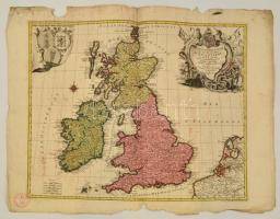
1764 Tobias Conrad Lotter (1717-1777): Nagy Britannia és Írország rézmetszetű térképe. La Grande Bretagne ou les Royaumes d'Angleterre et d'Ecosse comme aussi le Royaume d'Irlande. Lotter, Tobias Conrad. / Large map of Great Britain and Ireland. Colored etching. 58x49 cm
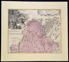
cca 1770 Csehország, az Olmüci részek térképe. Rézmetszetű térkép, a kartusban medve vadászat ábrázolásával. Paszpartuban.
/ Map of the Czech kingdom, Olomutz part. from the Homann Heirs: Atlas regni Bohemiae consistens in quindecim mappis... Nürnberg 1776. With a bear hunt in the cartuche. 57x45 cm
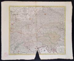
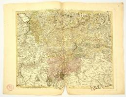
cca 1790 A Rajnavidék háborús térképe. Neue General Kriegs Karte Des Rheinstrohms, Herausgegeben von Iohann Walch im Willischen Kunstverlag in Augsburg. Nagyméretű, színezett rézmetszet, vászonra vonva, ki hiánnyal, egyébként jó állapotban. / Large war map of the Rhein river basin. Handcolored etching on canvas. small part missing, but otherwise in good condition. 60x136 cm
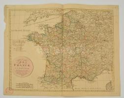
Franciaország térképe az 1790-es reform után. Jean Walch: Le Royaume de France en 83 departs suivant les decrets de 1790. Augsbourg, F. M. Nagyméretű színezett rézmetszetű térkép. / Map of France.. Large colored etching.64x53 cm
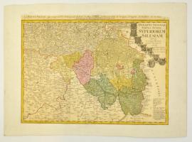
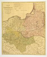
1798 Franz Ludwig Güssefeld (1744-1807): Charte von dem Königreich Preussen. Nach seiner Hauptabtheilung/ in Ost-West-Süd- und Neu-Ost-Preussen/ u. seinen Unterabtheilungen in Kreise./ Neu entworfen von F.L. Güssefeld/ 1798./ Nürnberg bey den Homann. Erben./ Mit Röm. Kayserl. allergnädigster/ Freyheit
Poroszország térképe. Színezett rézmetszet, körbevágott, kartonra kasírozva. / Large map of Prussian Kingdom. Colored etching. Cut margins. Glued on cartboard. 47x55 cm