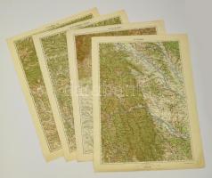
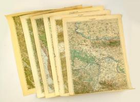
cca 1910 Katonai térképek gyűjteménye. Román területek / Collection of military maps. Romanian areas 4 pieces: Piatra, Targu Jiu, Ploiesti, Ramnicu Valcea, 63x48 cm
cca 1910 Katonai térképek gyűjteménye. Szerb és szlovén területek / Collection of military maps. Serbian and Slovenian areas. 6 pieces Kostajnica, Senj, Brod, Cilli, Mitrovica, Banja Luka, 63x48 cm
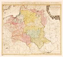
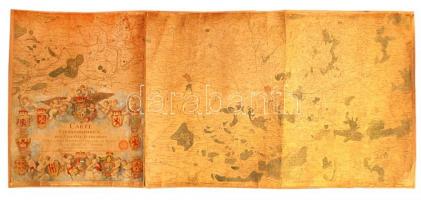
1773 Tobias Mayer; Homann Heirs: Carte des Etats de la couronne de Pologne, régi Lengyelország térkép. Színezett rézmetszet 51x47 cm /
1773 Tobias Mayer; Homann Heirs: Carte des Etats de la couronne de Pologne, map of Poland, Colored etching. 51x47 cm
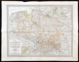
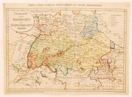
1799 Franz Müller: Postkarte von den Bayrischen und Schwaebischen Kreise (Tabula cursus circuli Bavarici et Suevici repraesentans), Bajorország térképe. Színezett rézmetszet. 51x38 cm /
1799 Map of Bavaria. Franz Müller. Colored etching 51x38 cm
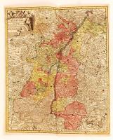
cca 1770 Georg Balthasar Probst (1732-1801): Landgraviatus Alsatiae tam superioris quam inferi cum utroqe Marchionatu Badensi...(Baden és Elzász térkép). Színezett rézmetszet. / cca 1770 Map of Alsace (Elsass) Colored etching. 37x44 cm
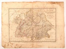
1835 Bajor és Würtembergi királyságok 'sa' Badeni Nagy Hertzegség földképe. Kissé viseltes, szakadt állapotban, 35x48cm/ 1835 Bavaria and Württemberg kingdoms 'and the' earth picture of the Grand Duchy of Baden. Slightly worn, 35x48cm
1777 Ferraris, Joseph de (1726-1814): Carte chorographique des Pays-Bas autrichiens, Osztrák Németalföld térképe, 12. sz. tábla, kézzel festett, vászonra kasírozva, sérült, 60×136 cm /
1777 Ferraris, Joseph de (1726-1814): Carte chorographique des Pays-Bas autrichiens, chorographic map of the Austrian Netherlands, table No. 12., handpainted, on canvas, damaged, 60×136 cm
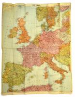
cca 1939 Nyugat-Európa térképe, Westermanns Generalkarten (Flemmings Generalkarten) No. 90.,1:3000000, Braunscheig-Berlin-Hamburg, Verlag Georg Westermann, gyűrődéssel, 84×108 cm./
cca 1939 Map of Western Europe, Westermanns Generalkarten (Flemmings Generalkarten) No. 90.,1:3000000, Braunscheig-Berlin-Hamburg, Verlag Georg Westermann, with crease, 84×108 cm.
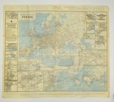
cca 1920 Németország és a szomszédos országok vasúti és vázlat térképe/ Európa főútvonalainak térképe, 1:2200000/1:10000000, Berlin, Deutsche Reichs-Posterklame, Reichsdruckerei, német nyelven, 70x80 cm./
cca 1900 Railroad and Overview map of Germany and neighboring countries/ Map of the Mainroads of Europe, 1:2200000/1:10000000, Berlin, Deutsche Reichs-Posterklame, Reichsdruckerei, in German language, 70x80 cm.