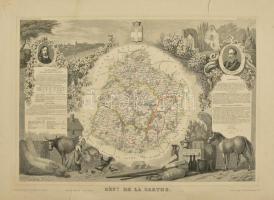
cca 1850 Départment du Sarthe (Franciaország) megye térképe, Atlas National Illustre, nagy beszakadással, 42x28 cm. / cca 1850 Map of Départment du Sarthe (France), Atlas National Illustre, with tear 42x28 cm
Die Webseite von Darabanth GmbH nutzt Cookies, um Ihnen die bestmögliche Surferfahrung zu garantieren. Durch das Weitersurfen auf dieser Webseite stimmen Sie der Verwendung der Cookies automatisch zu.