https://www.darabanth.com/
https://static.darabanth.com/
https://static.darabanth.com/auction/img/
https://www.darabanth.com/
Es ist verkauft
1 000 HUF
3
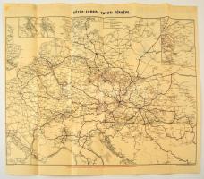
cca 1910 Közép-Európa vasuti térképe, Bp. Posner Károly Lajos és fia, a hátoldalán reklámokkal, hajtásnyomokkal, 47x58 cm./ cca 1910 Railroad map of Central Europe, with adds on the back, 47x58 cm.
Gesamtsumme