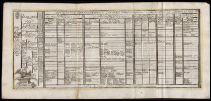
cca 1700 A Szent Római Birodalom felosztása 2 lapon. + A Német-Római Birodalom 10 térképe. Összesen 12 , színezett rézmetszet egy kihajtható Megjelent: Johann Hofmann Atlas Curieux oder neuer und Compendieuser Atlas. (Augsburg, 1700). Méret: 32x20 cm / cca 1700 Parts of the Holy Roman Empire on two colored etchings + 10 maps of the German-Roman Empire 31x20 cm
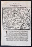
1550 Magyarország, Erdély és a Balkán térképe. De Ungaria, Transsyluania Ungarici regni prouincia. Sebastian. Munstero (1489-1552). Fametszetű térkép, megjelent Cosmographiae universalis lib. VI / Sebastian Munster. Basileae : apud Henrichum Petri, 1550. / 1550 Map of Hungary and the Balkans. Relief shown pictorially.21x30 cm
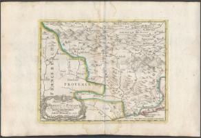
cca 1700 Johann Hofmann: Provance Olaszországban. Színezett rézmetszet. Megjelent: Atlas Curieux oder neuer und Compendieuser Atlas. (Augsburg, 1700?). Méret: 29x20 cm / cca 1700 Map of Provance in Italy. Colored etching 31x20 cm
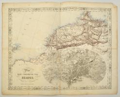
cca 1845-1847 Joseph Scheda (1815-1888): Plan der Umgebung von Neapel. Nápoly és kornyékének, valamint Északnyugat Afrika térképe, litográfia. Wien, K. K. Militärisch Geographisches Institut, foltos, kis szakadásokkal, német nyelven, 45x55 cm./ cca 1845-1847 Joseph Scheda (1815-1888): Plan der Umgebung von Neapel. Map of surroundings of Naples, and Northwest Africa, lithography. Wien, K. K. Militärisch Geographisches Institut, spotty, with a little tears, in German language, 45x55 cm./
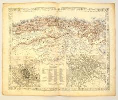
cca 1845-1847 Joseph Scheda (1815-1888): München és Berlin, és Észak Afrika térképe, litográfia. Wien, K. K. Militärisch Geographisches Institut, foltos, kis szakaadásokkal, német nyelven, 45x55 cm./ cca 1845-1847 Joseph Scheda (1815-1888): Map of München and Berlin, and North Africa, lithography. Wien, K. K. Militärisch Geographisches Institut, spotty, with a little tears, in German language, 45x55 cm./
Alte Karten im Lichtdruck. Fünf Karten Libyens und Sambias. Folge 11. Edition Leipzig, 1976. 1 térkép hiányzik. Kiadói hengerben. 3db 53x67cm, 1db 34x53cm
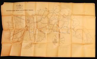
cca 1940 Magyarország távíró hálózatának térképe. Nagyméretű fali térkép 200x120 cm Sarkán kis, hiány, hajtásoknál egy-két szakadás, folt. / Large telegraph map of Hungary
Die Webseite von Darabanth GmbH nutzt Cookies, um Ihnen die bestmögliche Surferfahrung zu garantieren. Durch das Weitersurfen auf dieser Webseite stimmen Sie der Verwendung der Cookies automatisch zu.