https://www.darabanth.com/
https://static.darabanth.com/
https://static.darabanth.com/auction/img/
Das Lot is nicht erreichbar
6 000 HUF
16,44 EUR, 19,67 USD
0
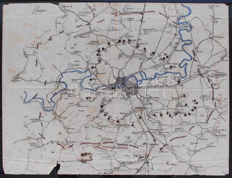
1916 Przemysl és környéke a frontvonalakkal és a szemben álló csapatok helyzetével. Kézzel rajzolt katonai térkép /
1916 Military map of Przemysl and it's surrondings with the location of the troops. Hand-drawn 34x44 cm
Gesamtsumme: