https://bid-notification.darabanth.com:443
https://www.darabanth.com/
https://static.darabanth.com/
https://static.darabanth.com/auction/img/
https://www.darabanth.com/
Tételek lista
Number of items: 62
Auction is over! Item soon called at the auction hall
Catalog number ascending
Catalog number descending
Starting price ascending
Starting price descending
12
24
48
72
1218548
12621
317
0
2000
Maps
Other collectibles
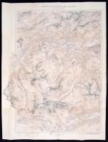
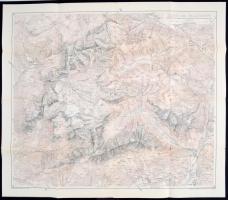
1913 Lechtaler Alpok térképe / 1913 Large map of the Lechtaler Alps 90x70 cm
The item is not available
Starting price:
2 000 HUF
1218544
12622
317
0
2000
Maps
Other collectibles
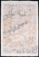
1911 Az Allgauer és a Lechtaler Alpok térképe / 1911 Large map of the Allgauer and the Lechtaler Alps 90x70 cm
The item is not available
Starting price:
2 000 HUF
1218555
12623
317
0
2000
Maps
Other collectibles
1898 A Schern és a Rosenthalergruppe térképe / 1898 Large map of the Schern and the Rosenthaler groups 50x70 cm
The item is not available
Starting price:
2 000 HUF
1218717
12624
317
0
2000
Maps
Other collectibles
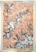
1930 Ausztria a Palagroupe térképe / 1930 Austria Large hiking map of the Palagroup 70x90 cm
The item is not available
Starting price:
2 000 HUF
1218713
12625
317
0
2000
Maps
Other collectibles
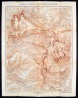
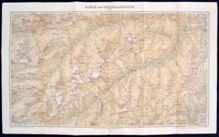
1899 Ausztria a Ferwallgroupe térképe / 1899 Austria Large hiking map of the Ferwallgroup 70x90 cm
The item is not available
Starting price:
2 000 HUF
1218661
12626
317
0
1800
Maps
Other collectibles
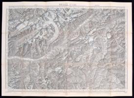
1930 A Zillerthali Alpok nyugati részének térképe / 1930 Large map of the Western part of the Zillerthal Alps 70x80 cm
The item is not available
Starting price:
1 800 HUF
1218646
12627
317
0
2000
Maps
Other collectibles
1913 A Brenni felföld térképe / Large map of the Brenn Oberland in Tirol Austria 50x70 cm
The item is not available
Starting price:
2 000 HUF
1591020
12628
317
0
60000
Maps
Other collectibles
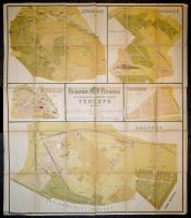
1887 Budapest főváros beépített kültelkeinek út- és a Tabánnak utcahálózati térképe. Szerkesztetett a fővárosi mérnöki hivatal földmérési szakosztálya által. Rajzolta és kőre metszette Jauernig Nándor főv. kőrajzoló. Bp., 1887, Légrády. Kiadói kissé sérült gerincű aranyozott egészvászon-köté, színes litografált térképlap, vászonra kasírozva, 84x99 cm.
The item is not available
Starting price:
60 000 HUF
1743704
12629
317
0
1400
Maps
Other collectibles
cca 1950 Kerekólak Csongrád megyében és vásárhelyi pusztában, fém nyomólemez, 25×19 cm
Starting price:
1 400 HUF
1743838
12630
317
0
1000
Maps
Other collectibles
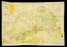
Magyarország légiforgalmi térképe. Váaszonra kasírozva. 120x80 cm
Starting price:
1 000 HUF
1748286
12631
317
0
10000
Maps
Other collectibles
Fabó Beáta - Holló Szilvia Andrea: Budapest térképeinek katalógusa. 1-3. [1-5.] köt. Bp., 2003, BFL. Papírkötésben, bontatlan csomagolásban, újszerű állapotban.
The item is not available
Starting price:
10 000 HUF
1747841
12632
317
0
8000
Maps
Other collectibles
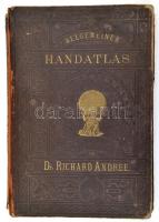
1881 Richard Andree's Allgemeiner Handatlas in sechsundachtzig Karten mit erläutern Text. Bielefeld & Leipzig, 1881, Velhagen & Klasing Verlag, 2 p.+96 t.+98 p. Német nyelven. Kiadói aranyozott félbőr kötés, rossz állapotban, kopott borítóval, sérült gerinccel, sérült kötéssel, kijáró lapokkal, foltos./ Half-leather-binding, in poor condition, damaged, in German language.
The item is not available
Starting price:
8 000 HUF
The bids are accepted according to the following bid increments:
up to 1.000 HUF
100 HUF
up to 5.000 HUF
200 HUF
up to 10.000 HUF
500 HUF
up to 20.000 HUF
1.000 HUF
up to 50.000 HUF
2.000 HUF
up to 100.000 HUF
5.000 HUF
up to 200.000 HUF
10.000 HUF
up to 500.000 HUF
20.000 HUF
up to 1.000.000 HUF
50.000 HUF
over 1.000.000 HUF
100.000 HUF
further page navigation Contact
Address:
Mailing Address:
Phone:
Fax:
E-mail
:
icvqw34r5 nf?3+ o@dasdfefg rabanwf34 th.codv4 m
Opening hours
Monday: 12-17
Tuesday-Wednesday: 10-17
Thursday: 10-19
Friday: closed
Weekend: closed
© 2011-2024 Darabanth Philatelic and Numismatic Auctions Co., Ltd.
We use cookies on the Darabanth website to enhance your user experience.
I agree
For details, please click here
https://www.darabanth.com/en/feltetelek/#privacy_policy
darabanth.com
Item added to the basket
Continue shopping

![Fabó Beáta - Holló Szilvia Andrea: Budapest térképeinek katalógusa. 1-3. [1-5.] köt. Bp., 2003, BFL. Papírkötésben, bontatlan csomagolásban, újszerű állapotban.](https://static.darabanth.com/images_thumbs/1/7/1748286.jpg)